12 August, 2025
The New South Wales Aboriginal Land Council (NSWALC) is pleased to share an important update with all Local Aboriginal Land Councils (LALCs). Please note, the below is in regards to the GIS Maps and Corroborate portal and only applies to those with access to these programs. If you do not have access, please contact the Land and Property Team at LPU@alc.org.au.
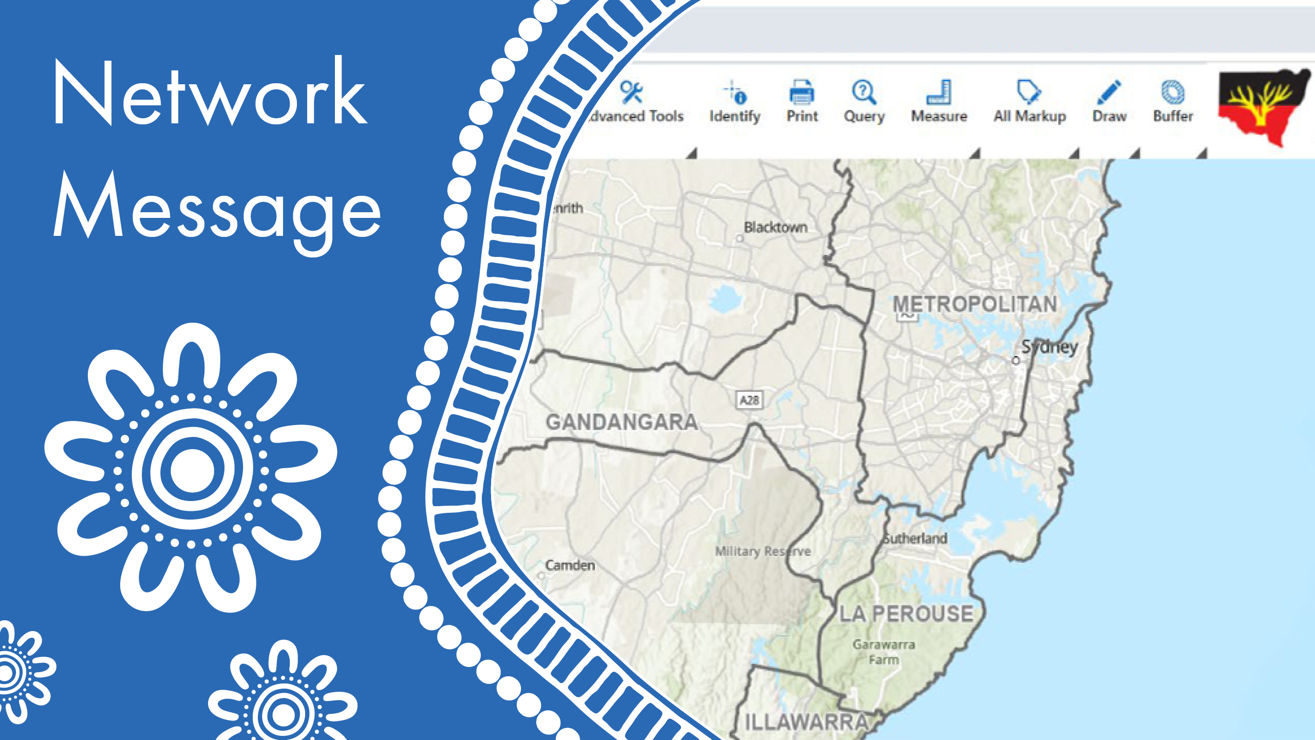
Introducing the new GIS Maps application
From Thursday, 14 August 2025, you will see a new “GIS Maps” button in the Corroborate portal menu. This will replace the former GIS Mapping Tool, which will be made unavailable from the same date. GIS Maps is built on the latest technology and offers each LALC across NSW a secure and safe space to explore geospatial data relevant to your interests and responsibilities.
Strong support for land-related work
GIS Maps brings together data that matters most to your LALC:
- Land claims, helping you track and map historical and current claims ‘on foot’.
- LALC-owned land within your boundaries.
- Zoning, Native Title, Crown Land, including Tenure and Reserves, all in one place.
What you gain
GIS Maps empowers your LALC in planning, managing, and caring for Country today and into the future.
Whether you’re mapping land claim history, managing Native Title areas, exploring zoning for development, or planning activation of owned lands, ‘GIS Maps’ will give you the tools to guide those decisions.
- Focused maps and data centred only on your LALC’s land.
- Interactive and intuitive visuals to plan how your land is used, activated, or cared for.
Important change
- From 14th August 2025, the old GIS Mapping Tool will no longer be available.
- GIS Maps is the replacement platform: available on the Corroborate Portal.
How do I access it?
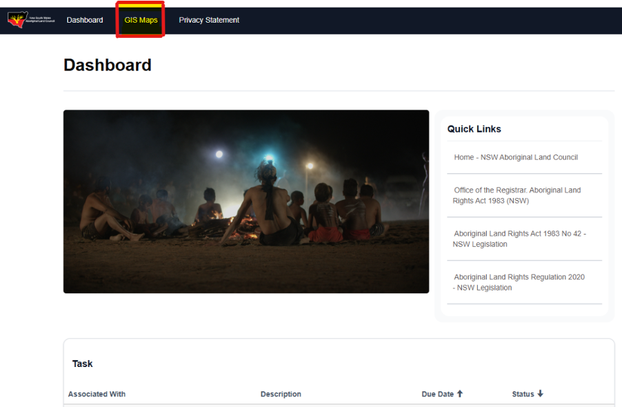
To use GIS Maps, simply log in to Corroborate by clicking here, or by going to the NSWALC website by clicking here, then click the Corroborate portal link in blue as per the screenshot below
The Corroborate dashboard should display a new button labelled ‘GIS Maps’ as per the screenshot below.
No new passwords are needed. When the button is clicked you should be granted direct access to GIS Maps, however if the Microsoft 365 login notification box presents itself, as per below.
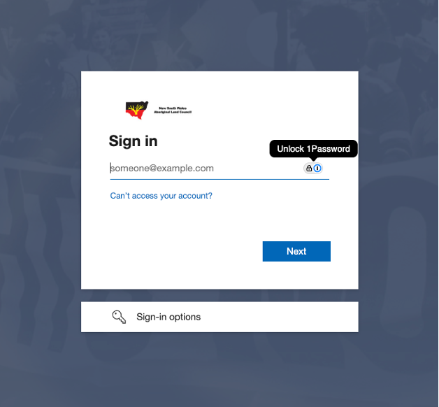
Re-enter your Corroborate portal email address, which ends in @alc.org.au, and click Next, then enter the password provided for use, to log into Corroborate.
The Corroborate portal is a place for Local Aboriginal Land Councils to collaborate with NSWALC. To access this portal, you can use the details provided to you when you were invited. If you need access to the portal, please email corroborate@alc.org.au to request access.
How do I use GIS Maps
For guidance on using the tool, please refer to the user guide by clicking the link here. If you still require additional support or training, please contact your local Zone Office.
GIS Maps Access Support Queries
LALCs are encouraged to log in to the Corroborate Portal directly for the GIS Maps tool. If you experience any issues with GIS Maps, please contact our Land and Property Team at LPU@alc.org.au